
Bestand:African continent-de.svg

Afmetingen van deze voorvertoning van het type PNG van dit SVG-bestand: 635 × 600 pixels Andere resoluties: 254 × 240 pixels | 508 × 480 pixels | 813 × 768 pixels | 1.084 × 1.024 pixels | 2.169 × 2.048 pixels | 1.525 × 1.440 pixels.
Oorspronkelijk bestand (SVG-bestand, nominaal 1.525 × 1.440 pixels, bestandsgrootte: 749 kB)
| Dit is een bestand van Wikimedia Commons. Onderstaande beschrijving komt van de beschrijving van het bestand daar. Controleer het gebruik van dit bestand in andere Wikimediaprojecten. |
Beschrijving
| Beschrijving |
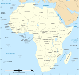
Deutsch: Politische Karte von Afrika als in 07-2011 (deutschsprachig)
English: Political map of the African Continent as in 2011-07 with German caption
Français : Carte politique du continent africain tel qu'en 07/2011 avec légende en allemand
Norsk bokmål: Politisk kart over Afrika på tysk.
Lambert azimutal equal-area projection, WGS84 datum, standard meridian: 15°E, standard parallel: 0° |
| Datum | 16 maart 2008, updated 2011-07 |
| Bron |
African continent-fr.svg
|
| Auteur | Eric Gaba, Jörg Schwerdtfeger |
| Andere versies |
[]
|
| SVG ontwikkeling | De broncode van dit SVG-bestand is deugdelijk. |


Licentie

|
Toestemming wordt verleend voor het kopiëren, verspreiden en/of wijzigen van dit document onder de voorwaarden van de GNU-licentie voor vrije documentatie, versie 1.2 of enige latere versie als gepubliceerd door de Free Software Foundation; zonder Invariant Sections, zonder Front-Cover Texts, en zonder Back-Cover Texts. Een kopie van de licentie is opgenomen in de sectie GNU-licentie voor vrije documentatie. |
| Dit bestand is gelicenseerd onder de Creative Commons-licentie Naamsvermelding-Gelijk delen 3.0 Unported | ||
| ||
| Deze licentietag is toegevoegd aan dit bestand in verband met de GFDL licentie-update. |
Bestandsgeschiedenis
Klik op een datum/tijd om het bestand te zien zoals het destijds was.
| Datum/tijd | Miniatuur | Afmetingen | Gebruiker | Opmerking | |
|---|---|---|---|---|---|
| huidige versie | 6 dec 2020 20:20 | | 1.525 × 1.440 (749 kB) | Sting | Swatziland => eSwatini |
| 4 okt 2012 13:38 |  | 1.525 × 1.440 (750 kB) | Svolks | SÃO TOMÈ --> SÃO TOMÉ | |
| 14 jul 2011 22:08 |  | 1.525 × 1.440 (750 kB) | Sting | Sudan/South Sudan 2011-07 border update | |
| 10 jan 2009 22:07 |  | 1.525 × 1.440 (745 kB) | Sting | Correction Sao Tome | |
| 27 jun 2008 03:51 |  | 1.525 × 1.440 (749 kB) | Sting | Completely new drawing with known projection ; new colors | |
| 16 mrt 2008 10:10 |  | 1.390 × 1.295 (611 kB) | Schwerdtfeger | ||
| 16 mrt 2008 09:42 |  | 1.390 × 1.295 (602 kB) | Schwerdtfeger | {{Information |Description= {{de|Politische Karte von Afrika (deutschsprachig)}} {{en|Political map of the African Continent with German caption}} {{fr|Carte politique du continent africain avec légende en al |
Bestandsgebruik
Dit bestand wordt op de volgende pagina gebruikt:
Globaal bestandsgebruik
De volgende andere wiki's gebruiken dit bestand:
- Gebruikt op de.wikiversity.org
- Gebruikt op es.wikibooks.org
- Gebruikt op ko.wikipedia.org